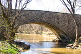
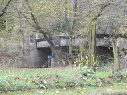
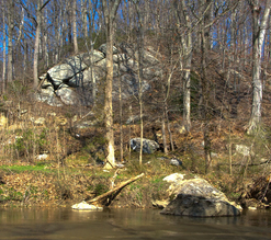
One of the best-known assets of Newlin Township is the West Branch of the Brandywine Creek which winds and twists its way through Newlin Township from the western border with East Fallowfield Township to the eastern border with Pocopson Township. Many small tributaries join up with the Brandywine as it makes its way through the Township creating meadows and flood plains along the way. Steep slopes and winding, curvy roads make a visitor feel that they are in the mountains at times. Native Hemlocks and Mountain Laurel grace the slopes as they melt away toward the Brandywine.
The history of Newlin Township revolves around the Brandywine Creek and tributaries. The Lenni-Lenape Indians once hunted and fished in the valley of Brandywine Creek. The last of the tribe, Indian Hannah who died in 1802, is buried in Newlin on the grounds of the old Embreeville Poorhouse located on the land of the now-closed Embreeville Hospital.
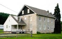
Mills and homes were built along the creek in Newlin with one of the earliest mills in historical records being at Embreeville. A deed from 1756 notes a corn, grist, and sawmill in the village. A house near the mill dates from 1760. The stone core of the mill still stands, with an addition dating from 1883. Nearby, Harvey’s Mill site and house date from 1780. The Passmore Mill and house, c. 1840, on Green Valley Creek, a tributary of the Brandywine, still stand and are currently dwellings. Commerce and homes were located near the mills. The National Historic Register lists 13 places and districts within the township including the historic districts of Embreeville, Green Valley and a portion of Northbrook.
Not far from the mill at Embreeville is the Stargazer’s Stone where, in 1764, English astronomers Charles Mason and Jeremiah Dixon began work on the farm of John Harland. Their task was to mark the border between the colonies of Pennsylvania and Maryland. The famous Mason-Dixon Line has been the traditional dividing line between the North and South and was known as the boundary dividing free states from slave states prior to the Civil War.
In 1724 Nathaniel Newlin took possession of 7100 acres from the Free Society of Traders who had purchased these acres and more from William Penn in 1681. In 1840-1 the Newlin tract of land became a township and was named after Nathaniel Newlin.
Today Newlin consists of 7,700 acres of which approximately 5,656 acres are protected from development through conservation easements to the Brandywine Conservancy, the sale of development rights to the Chester County Agricultural Land Preservation Board, and the most recent acquisition by the Natural Lands Trust of the ChesLen Preserve. The Preserve includes 1282 acres of Newlin Township in multiple contiguous parcels. There is clearly a strong commitment in the community to the preservation of the land.
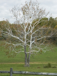
Rolling pasture land for cattle and horses, vineyards, an orchard, and farm fields give a real open feel to parts of Newlin. Corn, soybeans, hay and fruit production are important agricultural products of the Township.
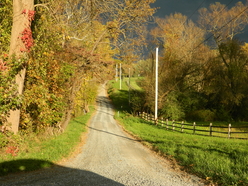
The 2020 census records a population of 1358 for the Township with a median age of 41.9. Total housing units are 539. Approximately 20 miles of roads in the Township are maintained by the Township and of that 20 miles, 7 miles are unpaved roads. State Routes 162 and 842 go through Newlin and are maintained by PennDOT along with 3 other roads in the township.
The Township owns 16 acres of land where the Township Maintenance Garage is located at 1751 Embreeville Road (Rt. 162). The Garage is where Township residents vote.